
SASMAP Project


About SASMAP Project

SASMAP’s purpose is to develop new technologies and best practices in order to locate, assess and manage Europe’s underwater cultural heritage in a more effective way than is possible today. SASMAP will take holistic- and process- based approaches to investigate underwater environments and the archaeological sites contained therein. This is necessary regardless of whether or not investigations are research driven or in connection with sub-sea development. Investigations of underwater heritage which are associated with subsea developments in Europe often require pre-disturbance studies to comply with the Treaty of Valletta (1992).
Cost effective methods to locate and assess the dimensions of archaeological sites both on and beneath the seabed are essential. The presence and extent of potential threats to archaeology must also be determined. Threats may arise from the natural physical environment including strong currents, from manmade hazards such as dredging, from construction work, fishing, installation of pipe/cable lines and development of recreation centres. The stability of the site and the state of preservation of the artefacts present must also be assessed. The various assessments provide information on how best to approach or manage a site. If the physical and bio-/geochemical environments are unstable or pose a threat to the site, the opportunities for stabilising it in situ must be determined. The options for monitoring the continued integrity of the site must be identified. If none exist, it needs to be determined whether areas can be identified that need to be excavated, or sampled non-destructively, before information is lost.
SASMAP will benefit the management of underwater cultural heritage in Europe and in the rest of the world by providing valuable tools to plan the preservation of offshore archaeological sites and their contents in accordance with both the Treaty of Valletta (1992) and research driven investigations.
Why SASMAP?
The need for SASMAP is based on the results from previous and current EU initiatives, the networks resulting from these projects and on-going research at the consortium’s institutions. The proposed pan- European consortium includes partners who have been involved in previously funded and successfully completed projects related to underwater cultural heritage, namely The MoSS Project, MACHU, BACPOLES and Wreck Protect. In addition, partners have also worked in The Baltic Gas Project and The Balance Project reflecting the interdisciplinary nature of the consortium. It also contains partners from the networking opportunities provided by the COST Actions IEO601 Wood Science for Conservation of Cultural Heritage (WoodCultHer) and TD0902 SPLASHCOST concerning submerged prehistoric landscapes. Many of these projects are directly related to the current ethos within maritime archaeology and conservation, namely to preserve underwater cultural heritage in situ, that is to say where it lies on or in the seabed. Within Europe this has been politically galvanised by the Valetta treaty (1992) and internationally by UNESCO’s Convention for the Protection of the Underwater Cultural Heritage (2001). Both these treaties advocate that, as a first option, the underwater cultural heritage should be protected in situ and, where possible, non‐intrusive methods to document and study these sites in situ should be used. This is understandable in terms of the underwater cultural heritage resource. UNESCO currently estimates that, “over 3 million wrecks are spread across ocean floors around the planet”. This figure does not include the numerous submerged landscapes (and archaeological sites therein), found around Europe as a result of postglacial sea level change.
It is financially prohibitive in either research- or development lead investigations to excavate, conserve and curate the many finds. In Danish territorial waters alone, it is estimated that there are 20,000 submerged settlement sites lying around the present day coastline and out to a water depth of 30 – 40 metres. The recently completed EU supported project WreckProtect carried out a cost benefit analysis for the costs of excavation, conservation and curation versus in situ preservation. A single large wooden wreck, such as the Mary Rose in the UK, has to date cost ca. 80 million Euros to raise, conserve and exhibit, whereas the physical in situ preservation of a similar sized wreck in Sweden cost around 0.07 million Euros.

Even though at first glance it appears to be several orders of magnitude more economical to preserve an archaeological site in situ, efficient and well informed management requires significant investment of resources to continually monitor and safeguard these sites. SASMAP will develop and assess tools, techniques and methods in order to develop best practice for the cost effective and successful investigation and management of underwater cultural heritage.
The SASMAP Concept
Within SASMAP a holistic approach will be taken to locating, assessing, monitoring and safeguarding underwater cultural heritage. This will involve developing and utilising tools and technologies to allow “down-scaling” from the large scale regional level, moving on to the local site level and finally to the individual components of a site as shown in Figure 1.

Results obtained from the down-scaling approach at the proposed study areas will show the effectiveness of such an approach for locating and detailed mapping of archaeological sites and their preservation potential. The end results of this approach will be used to develop a plan for assessing archaeological sites in European waters. From a management point of view this is an up-scaling approach to planning (bottom up). All information and experiences obtained during the course of the project will be utilised to enhance and develop existing legislation and best practice for mapping and preserving Europe’s underwater and coastal heritage.
SASMAP has multiple objectives that all have as their aim to develop a structured and optimized approach to safeguarding underwater cultural heritage. The objectives are:
• to develop regional specific geological models to understand palaeogeographic developments and use them to evaluate the probability of finding submerged archaeological settlement sites and of preserving them
• to optimise the selection process of the target region ideal for non-destructive down-scaling studies based on the regional specific geographical models. Tools used will range from regional satellite scanning of theoretical optimal target areas, detailed multibeam and shallow seismic surveying of selected target areas to new development and innovative use of 3D shallow seismic investigations of identified targets. Data from these non-destructive studies will be directly applicable to Geographical Information System (GIS) presentation, interpretation and modelling of the physical appearance of the archaeological sites. The GIS will be custom made for input of hydrodynamic and sediment regime data in order to evaluate site stability and preservation status.
• to monitor biogeochemical parameters in typical littoral marine sediments by developing a data logging device. Measurements will be related to the degradation of organic archaeological materials in the marine environment and used to assess the preservation potential of sediments.
• to develop new technologies in the form of prototype diver-held tools for sampling sediment cores from archaeological sites, and tools for assessing the state of preservation of waterlogged archaeological wood.
• to develop and demonstrate innovative techniques to raise complex and heavily degraded waterlogged organic archaeological artefacts.
• to develop and monitor the efficacy of using artificial seagrass and other synthetic materials to stabilize sediments around archaeological sites. The durability (deterioration) of the synthetic materials most frequently used when preserving sites in situ will be assessed.
• to transfer knowledge and training in the use of the newly developed technologies through a field school and workshop. This will be aimed at potential end users of the SMEs involved and students, institutions, stakeholders and end users responsible for the management of underwater cultural heritage. Knowledge transfer will inform future generations of marine archaeologists and cultural resource managers about cutting edge technologies and marine spatial planning on a European scale.
The down scaling tools and methods outlined above will be trialled in the field on two shallow water submerged sites in Denmark (Tudsehage) and Greece (Cape Sounion). The up-scaling methods will be trialled on a shipwreck site in the Netherlands (BZN 10) and a submerged shallow water site in Italy (Underwater Heritage Park of Baia) (Figure 2). The geological and geographical characteristics of all these sites are significantly different. SASMAP will improve current best practice for protecting underwater cultural heritage. It is the intention to incorporate the resulting guidelines into European CEN standards (CEN /TC 346) concerning the protection and management of cultural heritage at the end of the project.

Overall status after the first year
In at the deep end!
Status of the project October 2013
Following contract negotiations the project started on the 1st of September 2012. The kick off meeting was held in Brussels, with representatives from all partners at the end of September. At the time of writing the project has effectively been running a year since the kick off meeting; and what a year! The project really started by jumping in at the deep end with all Work Packages effectively starting simultaneously.
The satellite imagery and data for the development of WPs 1 and 2, along with the collection of the first geophysical data sets on the sites in Denmark and Greece, have all successfully been gathered. Equipment has been developed and tested in WPs 3 and 6 in the first phase of field work on the various sites in the project over the Spring and Summer of 2013. It is only through the extremely hard work of all consortium members both in the office, laboratory and in the field that the project has reached this far and is still on track. The winter of 2013 will see the further development of the models and databases in Work Packages 1 and 2. Work Package 3 will see refinement of equipment after the steep learning curve from the first field seasons trials and laboratory work to study the deterioration of organic materials will start. Work package 4 will see the further development of the hand held wood tester and Work package 5 will see evaluation of the methods trialled so far and further development of proofs of concepts for how best raise to raise fragile artefacts. The sea grass mats from WP 6, which have now been placed on site will be monitored, where possible, after winter storms to study their effects.
The overall aim of the project is to synthesise the results of the Work Packages into two guidelines which will be published in 2015 but a progress report of the first year’s results is available as a downloadable pdf.
David Gregory

Overall - SASMAP
The project is structured in 8 well integrated work packages (WPs), each headed by a WP leader, which proceed in a logical order so as to achieve the stated meassureable objectives. All partners possess the necessary expertise and facilities to carry out the work specified in the work programme. The overall concept of the project is to use a down-scaling approach to the location and assessment of underwater archaeological sites. Having localized potential sites an up-scaling approach (bottom up) will be taken to developing technologies, tools and best practice methods for preserving them in situ or ex situ. WPs 1 and 2 focus on development of models to allow desk based assessment of the potential of finding archaeological sites, their stability and then how to localise these sites with remote sensing tools. WPs 3-6 focus on the development of tools and technologies and best practice on how to deal with localized archaeological sites and how they should best be preserved in situ or excavated and raised (ex situ).

WP1 focuses on the development of two geological models for the two case study areas in Denmark and Greece. It involves collecting and harmonizing satellite imagery with pre-existing information including seismic, sedimentological, and biostratigraphic data in order to elucidate palaeogeography (sedimentary conditions and water level fluctuations over time) and palaeoenvironment. The models will be used to assess the potential of finding underwater archaeological sites in these environments and assessing their stability. This information will feed directly into WP2 in which target regions for non-destructive down-scaling studies will be selected. The two case study areas will be incorporated into two GIS systems (one for each site). Based on the models from WP1 and the GIS, those areas on the case study sites most likely to contain archaeological remains and prone to further deterioration will be surveyed with a suite of remote sensing geophysical tools, including a 3D sub bottom profiler which is being specifically developed within the project. The results of these surveys will be incorporated into the GIS in order to provide tools for localizing, mapping and monitoring underwater archaeological sites. The final GIS will be incorporated into the existing MACHU GIS database. WP3 and WP4 focus on the development of tools and technologies and best practice to assess the burial environment both through in situ logged and ex situ measured parameters, indicative of the deterioration of organic archaeological materials and in situ assessment of the state of preservation of waterlogged archaeological wood. Should it not be possible to preserve a site in situ WP5 addresses the development of tools and best practice for the raising of poorly preserved organic artefacts. WP6 will investigate the use of methods to stabilize sites in situ, monitor their effects on sites and how typical materials used for in situ preservation interact with the marine environment. The tools developed in WPs 3-6, in conjunction with WPs 1 and 2, will enable a dual-scale (down and up scaling) approach to the location, assessment and management of hitherto unknown underwater archaeological sites. WP7 focusses on dissemination of the project results and further exploitation of the technologies developed. WP8 is devoted to the management of the project.
Geological models, WP1
Geological models using existing data and satellite 3D images for regional evaluation of probability of locating archaeological sites and their preservation potential.
Type of Activity: RTD
Objectives: To develop geological models of the two case-study sites in Denmark and Greece to be used in the project. This will be achieved through the use of existing data such as seismic, sedimentologic, bio-stratigraphic, and sediment dating datasets together with 3D satellite images to produce palaeogeographic as well as palaeoenvironmental models for the two study sites. Both models will be combined with existing archaeological development history to produce geo-archaeological models. These models will be used to assess the potential for archaeological sites on a regional scale. The results of WP1 are essential for progress within WP2 and the rest of the project.

Surveying and Monitoring, WP2
Development of tools for surveying and monitoring coastal and underwater archaeological sites
Type of Activity: RTD
Surveying and monitoring archaeological sites is a prerequisite for the assessment of physical and geochemical stability. Remote sensing techniques are one of the most cost effective tools for regional scanning of the seabed surface sediments and morphology by full or semi-automated classification based on reflectivity index. On underwater sites, sidescan sonar, sub-bottom profilers, magnetometers, and single and multibeam echosounders have been used to locate and map archaeological sites both on and within the seabed for many years. One of the significant strengths of the SASMAP project is building on existing technologies.
The Burial Environment, WP3
Assessing the burial environment and deterioration of organic archaeological materials
Type of Activity: RTD
Objectives: Biogeochemical processes in young (i.e. during early diagenesis) sediments are directly connected with the degradation of organic matter. Organic matter may be produced by algae and other organisms in open water, which subsequently sinks to the seabed and becomes incorporated within the sediment. It may also be the remains of plant material such as eelgrass, seaweed or, archaeological materials deposited or incorporated within sediments. The utilisation (turnover) of the organic matter by organisms within sediments involves oxidation – reduction (Redox) reactions. These reactions follow a well-documented succession (Figure 13) with various chemical species being utilised based on the amount of energy they yield.
From the pool of potential electron acceptors, the microbial community selects the one that maximises energy yield from the available substrate. This is partly due to metabolic regulation within a single population and in part due to the competition between several populations with diverse metabolic capabilities. In marine sediments, the sequence of electron acceptor utilisation can be observed spatially in horizontal layers of increasing depth. In typical coastal marine sediment, only the first few millimetres of the sediment are oxygenated, though bioturbation by invertebrates may extend this oxygenated zone downward.

For a few centimetres under the oxygenated zone, nitrate serves as the electron acceptor followed by manganese and iron oxides. Below this, sulphate is the principal electron acceptor. Methanogensis, is usually confined to the sulphate depleted deeper sediment layers, though the generated methane may diffuse upward into the zone of sulphate reduction. Thus, the deterioration of organic matter and therefore archaeological artefacts / information still occurs in anoxic environments due to the activity of anaerobic organisms. Assessment of the rate of turnover of organic material is important if we are to assess both the preserving capabilities of marine sediments on archaeological sites and the potential state of preservation of organic archaeological materials.
The objectives of WP3 are to develop tools to enable the sampling and characterisation of marine sediments both in situ and in the laboratory to assess the potential for preservation of organic archaeological materials. To achieve this the following will be carried out:
• Develop and test in situ data logging device which can characterize the environment of marine archaeological sites both in the open water and sediment environment
• Develop and test diver held technology to sample sediments from archaeological sites
• To establish a best practice method to characterize the preservation potential of sediment on marine archaeological sites. This will be achieved by assessing the rate of turnover of organic material based on information provided by the datalogger and sediment samples and microscopic analysis of waterlogged archaeological wood.
• Correlate the data obtained from the sub bottom profiler in WP2 with the environmental data in order to assess the potential of using this system to remotely assess the preserving capabilities of sediments.
Waterlogged wood, WP4
Assessment of the state of preservation of waterlogged archaeological wood
Type of Activity: RTD
Objectives: Waterlogged wood is one of the commonest materials found on underwater archaeological sites. An exact assessment of its state of preservation is necessary in order obtain bench mark data for wood that is to be preserved in situ, or re-buried, or to select the optimal conservation process should it be excavated and raised. Archaeological wood from waterlogged environments differs from recent wood due to the effects of physical, chemical and biological degradation. Animals, fungi and bacteria living in the surrounding water or sediment cause degradation, and wood only survives for longer periods under anoxic conditions.
Under these conditions, bacteria are the primary degraders of wood (Figure 18), decomposing the cell wall from the lumen towards the middle lamella. The outer shape of the wood stays intact, whereas the density, and thereby the strength properties, are often reduced. Larger artefacts, such as ships timbers, often show an outer degraded layer with a less degraded centre. Smaller artefacts can often be heavily degraded, with only the middle lamella remaining, and a density as low as 50 kg/m3.

Assessments of the state of preservation until recently have included analyzing the chemical composition (lignin, cellulose, other cell wall components); and physical properties (tendency to collapse and shrinkage, bulk density, maximum water content, compression strength and porosity/diffusion coefficient). These assessments are sometimes destructive, and require representative samples to be taken from the artefact and analysed in the laboratory.
The objective of WP4 is to:
• develop and test non-destructive hand held and diver held tools to quantitatively assess the state of preservation of fully waterlogged wooden artefacts both in the laboratory and in situ underwater.
Go to scientific research progress.
Raising artefacts, WP5
Tools and techniques to raise waterlogged organic archaeological artefacts
Type of Activity: RTD
Objectives: Waterlogged organic artefacts can be extremely fragile, due to microbial deterioration processes (discussed in WP3). Therefore these types of remains can be challenging to excavate, support, raise and transport to conservation facilities. This is due to the inherent difficulties of working underwater (limited time and potentially harsh conditions) and in particular the crucial stage of lifting artefacts from the seabed to the surface where mechanical damage can easily occur. Submerged prehistoric sites, in particular, contain a wealth of the aforementioned organic materials and complex structures such as fish traps (Figure 20).

To overcome this, artefacts are often raised on supporting materials or in sediment blocks (block lifting), whereby the artefact is excavated with surrounding sediment and subsequently excavated under controlled conditions on land in the laboratory. Methods of encapsulating and block lifting have been used in the past to address this, yet can be very time consuming underwater, with artefacts being left exposed to physical damage at crucial stages while consolidating materials are allowed to “set” underwater. The objective of
WP5 is to:
• To develop and demonstrate new technologies to stabilize and consolidate fragile and complex organic archaeological on the seabed in order to facilitate their raising and transport to conservation facilities.
In situ preservation, WP6
In situ stabilization of underwater archaeological sites
Type of Activity: RTD
Objectives: Sites which are preserved in situ are often threatened by the effects of underwater currents which can cause sediment to be removed from sites, leading to their exposure. Upon exposure sites are susceptible to mechanical abrasion and erosion, which can lead to their total loss. Furthermore, exposed wooden artefacts can, under the right environmental circumstances, be attacked by wood boring organisms such as shipworm. The activity of wood borers can be prevented by covering the wood with sediment, which creates conditions preventing their survival. In Italian and Greek archaeological sites, wooden artefacts are often located in association with stone / marble objects and structures, which are today submerged, due sea level change or seismic activity. Degradation mechanisms called bioerosion produced by endolithic organisms represents one of the most aggressive and destructive forms of biodeterioration, together with biofouling. Although this type of degradation may not initially seem particularly serious, it is one of the most aggressive phenomena that can lead to the total destruction of the artefact.
The aims of the work package are:
To develop assess and monitor the applicability of artificial seagrass to the in situ protection of underwater archaeological sites with wooden and stone remains.
To evaluate the durability of man made materials used for the protection of underwater archaeological sites
Dissemination, WP7
Dissemination of the Project
Type of Activity: RTD
Objectives: The overall objective is an effective dissemination of the tools, techniques and best practices developed within the project to authorities within Europe, responsible for the protection of underwater cultural heritage. Stakeholders, museums, conservators, and archaeologists, both outside and inside our network, are the target of this information. Consequently, the following activities are included:
To develop and implement a dissemination strategy for the project aimed at both managers of the underwater cultural heritage and potential end users of the tools and technologies developed within the project.
To develop best practice Guidelines for stakeholders and managers of underwater cultural so as to improve the decision making process in the management of the underwater cultural heritage.
To run a field school and seminar for end users and stake holders to enable transfer of knowledge from the project.
Management of the project, WP8
Management of the project
The successful completion of a complex project such as this requires extensive coordination and communication between the partners of the consortium. Needless to say, the numerous milestones, Gantt diagrams and report “Deliverables”, prepared as part of the project provide a good “Road Map” of where and how the project is going. The consortium have currently had two meetings – the kick off meeting in Brussels in October 2012 and the 1st consortium meeting in May 2013 in Copenhagen (Figure 44). A third meeting of the consortium meeting will take place in the early spring of 2013, coinciding with the mid-term assessment of the project.
On top of this numerous meetings have been held within the various Work Packages and at the various partner’s institutions over the first year in order to fine tune scientific goals and plan elements of equipment development and field work. This has also entailed many e-mails, phone calls and Skype meetings.
Suffice to say, it is through this good communication between partners, patience and hard work that the consortium is currently on track for the second year of work within SASMAP.
David Gregory
Progress
Development of tools and techniques to Survey, Assess, Stabilise, Monitor And Preserve underwater archaeological sites (SASMAP) is a three year project (2012-2015) funded by the EU FP7 framework and involves 11 partners from seven European countries.
SASMAP’s purpose is to develop new technologies and best practices in order to locate, assess and manage Europe’s underwater cultural heritage.
The first year of the project has involved intensive collection of remote sensing and geophysical data to facilitate the location and mapping of underwater sites.
Furthermore, tools to assess the environment and its effects on organic archaeological materials along with methods to protect archaeological materials both in situ and during excavation have all been under development in the first year of the project.
2013
WP2
Status after the first year (WP2)
Results September 2012 - 2013
The remote sensing, geophysical surveying and the production of a geological model are well under way for the test sites at Tudse Hage, Denmark, and Cape Sounion, Greece (Figure 1).

Considerable progress has been achieved during the first year of the project. In WP1 the World View 2 high resolution satellite images for the test site areas were obtained, (Figure 2a,c).
Below you find 2 World View satellite images at (A) Tudse Hage /DK; and (C) Cape Sounion /GR. Also shown bathymetry data extracted from the satellite images at (B) Tudse Hage, and (D) Sounion.
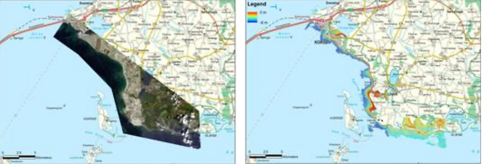

These figures reveal the 8 band satellite images as well as the calculated bathymetry deduced from the satellite images calibrated with measured points provided by the relevant partners. The bathymetry was truncated to 5-6 metres depth at Tudse Hage and 12 metres at Cape Sounion due to water clarity and seabed slope. The satellite images, the bathymetry, the sediment map, available information and expert judgment were used to optimise the planning of the areas where the geophysical survey was later conducted.
The field work was conducted in the summer of 2013 and the data was analysed and potential locations for coring were delineated (Figure 3). Coring off-shore was conducted at Tudse Hage Denmark. The core samples will be used for dating and construction of the geological model and the paleogeographical environment of the area. To get a complete sequence of sea level rise in the area which will positively determine probable locations of potential archaeological sites in the Tudse Hage study area, an on-shore GeoRadar survey was suggested at the on-shore region east of the area where off-shore coring took place; this will be conducted in October 2013 and sediment cores will also be taken from the area for dating.
In the Greek study area (Cape Sounion) field work included the gulfs of Passalimani, Pountazeza, Sounio and Legrena and was conducted using multibeam, side scan sonar (two systems), sub-bottom profilers (two systems) and magnetometer. The data collected will be compared with each other and with the data from the satellite images. Furthermore the results of the geophysical survey will be combined with the submerged archaeological findings in order to depict the geological model and the palaeogeographic evolution of the coastal zone of the area.

Figure 3: WP2 field work activity in 2013. A: Multibeam echosounder on board Maritina, DK. B: Coring at Tudse Hage with a coring raft and a Russian Corer, DK. C: Extracted sediment cores, DK. D: Processed multibeam bathymetry data merged with satellite bathymetry and land DTM, DK. E: Sidescan image of the survey area, DK. F: Seismic profile taken with Innomar parametric sub-bottom profiler, DK. G: Survey boat with sidescan fish in Sounion, GR. H: Survey lines for the geophysical survey, GR. I: Sidescan image of a surveyed area in Sounion, GR.
An innovative sub-bottom 3D imaging system is being developed and will be used in the allocated test sites for detailed studies in the Summer of 2014. A parametric transducer array has been designed and manufactured by Innomar Technologie GmbH,. The transducer was field tested in a local Marina and data have been collected for further analysis. Preliminary results indicate that the array is working within its design specifications.
The next step in these work packages will be the production of a GIS based database encompassing all the background data used in the production of a geological and palaeogeographic model. The model and the archaeological information of prehistoric sites will be incorporated into a GIS platform where the potential archaeological sites in the test site areas and their environmental status and stability are elucidated. The 3D sub-bottom profiler will be used in the surveyed test areas to produce a fully geo-referenced 3D image of the archaeological sites.
Zyad Al-Hamdani, Maria Geraga, George Pantopoulos, George Papatheodorou and Jens Wunderlich.
WP3
Status after the first year (WP3)
Results September 2012 to October 2013
The winter of 2012 and spring of 2013 saw an intensive development of the vibracoring device carried out by AKUT, with preliminary field testing in collaboration with the National Museum of Denmark. At the same time Unisense began work on developing the data logging systems. Shortly after the start of the project it was decided that two separate systems should be developed to best achieve the desired results of measuring and logging environmental parameters in both the open water and sediments. These were to be based on existing systems within the Unisense range of products, yet entailed considerable re-development and integration of new software and hardware. The various equipment designed was trialled in earnest in the Summer of 2013 on the site of Tudse Hage in order to get a first impression of the applicability of the first concept devices.
Vibracoring System
The specifications for the vibracoring system were such that it should:
be able to take samples down to a depth of 50 cm in the seabed
be diver held and ideally operated by one diver only
be easy to pass/vibrate into the bottom and easy to retrieve
be able to preserve the core with a suitable sediment retainer
ensure best possible preservation of the core, in order to take gas measurements and pore water analysis through sealed holes in the coring tube.
In general the system should improve upon currently available corer systems in terms of diver deployment, retrieval and ease of analysis of samples. The resultant system based on the above criteria consists of the following:
80 mm diameter polycarbonate tube for collecting the sediment samples although smaller tube sizes can be relatively easily adapted
An interchangeable vibrator head
A pneumatic vibrator providing longitudinal vibrations
A spring connecting vibrator with weight
Weight system for creating downward force on vibrator and coring tube
A lifting bag connected to the weight for balancing the unit
A “handle bar” with operating valve
An exhaust system with buoyancy
The vital part of the corer is the vibrator. A pneumatic driven unit was selected, as divers are familiar with compressed air and because compressed air is available in connection with diving activities. The unit can be supplied by an umbilical cord from the surface or from tanks at the bottom depending on numbers of samples to be made, working depth, and the facilities of the supporting dive vessels.
The coring tube is made of transparent polycarbonate. The tube has a simple system for attachment to the vibrator head and for allowing water to escape the coring tube during penetration. Both systems can easily be operated by divers even with gloves. The coring tube is mounted on the vibrator by an interchangeable head, in order to be able to use tubes of different diameters. The head also makes changing of coring tubes under water simple. The downward force on the tube is achieved by a weight with a diver held “handle bar” connected to the vibrator through a spring. The spring protects the diver from the vibrations and insures that all vibration energy is channelled to the coring tube. The weight system is connected to a lifting bag, making it possible to adjust the downward force by regulating the amount of air in the bag. The lifting bag can be filled by exhaust air from the vibrator and provides upward force to ease the retrieving of the core from the seabed.

Datalogging Systems
Open water
The open water data logging system was to be based on the lander technologies that Unisense have currently developed. The parameters to be measured were standard CTD data (conductivity (salinity), temperature and depth data) and an Acoustic Doppler Current Profiler (ADCP water current meter). Integration of these instruments and modification of hardware, software and firm ware took place over the Winter of 2012 – 2013 ready for an initial trial on the site of Tudse Hage in the Summer of 2013.

Sediment profiling system
It was desired to measure sediment profiles in situ using a diver based datalogging system down to a depth of 50 cm. An existing diver operated underwater meter manufactured by Unisense was re-developed for this purpose. The standard equipment has the capability of measuring dissolved oxygen, pH, redox and sulphide using Unisense’s microsensors that are fitted with hypodermic needles to give them added robustness. However, this system was developed for measuring in the upper few centimetres of sediments; not profiling down to 50 cms depth. As with the open water data logger extensive development of the existing equipment and a “spear” system, which could be pressed into the sediment was developed. This again required re-configuration of the hardware, software and firmware of the existing underwater meter and the re-design of sensors to fit into the spear system which would be relatively easily operable by a diver underwater. The concept was to make a hollow spear which could be hammered into the sediment to the desired depth and then the sensors placed into this to take the desired measurements.


Field work, Tudsehage, Denmark
Preliminary Field Testing in Tudse Hage August 2013
At the end of August all equipment was ready for the first serious field trials on the site of Tudse Hage. The team consisted of partners from the National Museum of Denmark, the Viking Ship Museum, AKUT, Unisense and the University of Gothenburg. Field work took place over two weeks with the first week dedicated to localisation and preparation of suitable areas for testing and monitoring of the artificial sea grass mats (see section on WP6 in situ preservation). The second week was trialling of the various systems developed. Following kind permission from the Danish Cultural Heritage Agency it was agreed that there could be minimal intervention on the site in order to trial the equipment and take sediment, wood samples and place modern wood into the site. The vibracoring system was to be used in order to obtain cores for further analysis in the field and laboratory. Profiles of the aforementioned parameters were to be measured in the cores in the field in order to compare these results with in situ profiles measured using the in situ spear /sediment profiler so as to compare and validate both methods. The open water data logger was trialled around one of the artificial sea grass mats to see if differences in current strength and direction around the mat could be determined. Samples of archaeological wood were also taken from the various layers of the site in order to examine their state of preservation, which could be compared with the environmental parameters measured in the cores and with the in situ profiling equipment. Similarly, modern samples of wood were placed into the site so that their deterioration processes could be examined over time.
Testing of the open water datalogger
In connection with the trialling of the artificial seagrass the open water datalogger was to be placed on one of the mats near Tudse Hage. The idea was to log data over two days on the shoreward side of the mat and then move it to the off shore side. The hypothesis being that there may be more current on the off shore side due to the greater fetch from the Great Belt and in this way it may be possible to see if the seagrass was actually reducing any eventual currents and thus prevent any resultant scouring of sediment. The logger was assembled in the harbour of Skælskør and transported onto site using a small vessel (6.2 metres). Although relatively large and heavy the logger was easily lowered by two people onto the seabed (Figure 6). A single diver was then able to position it in the correct orientation on the seabed and on the onshore side of the mat. Following logging for two days the logger was moved to the opposite side of the seagrass mat (off shore), using a diver on the seabed and support on the surface. CTD and current data were successfully collected and are currently undergoing post processing. The system will be trialled further in the coming year of the project.

The test area in Tudse Hage
A 1 × 1 metre test pit which had been previously excavated and re-buried as part of the Viking Ship Museum’s investigations on the site between 2009 – 11 was selected as the test area (Figure 8).
This pit had yielded a ca 50 cm profile of sand / gravel and organic gytjja with numerous fragments of wood (both worked and natural) overlying the natural clay and provided the perfect area to test the vibracorer and in situ spear / profiler.

The test area in Tudse Hage
A 1 × 1 metre test pit which had been previously excavated and re-buried as part of the Viking Ship Museum’s investigations on the site between 2009 – 11 was selected as the test area (Figure 8).
This pit had yielded a ca 50 cm profile of sand / gravel and organic gytjja with numerous fragments of wood (both worked and natural) overlying the natural clay and provided the perfect area to test the vibracorer and in situ spear / profiler.

Nevertheless, the cores were quickly taken (ca. 10 minutes per core) (Figure 10) and the experience of working on an actual site and in shallow water gave rise to numerous improvements to the system, which will be worked on in the coming months.

The cores were taken back on land and profiles of dissolved oxygen, pH, redox potential and sulphide were taken using Unisense’s standard laboratory sensors (Figure 11).

In situ spear / sediment profiler
Measurement of environmental parameters within cores, either using microsensors or from extracted pore water, is currently the most frequently used method for analysing environmental parameters within sediment. However, it is advantageous if these parameters could also be measured in situ. The in situ profiler system was trialled in two areas adjacent to where the cores had been taken in order to compare and contrast the methods and in this way validate both methods. In this instance only sulphide microsensors were used as the main aim of this trial was to test the use of the equipment. The first impressions of the system were such that the meter in itself was extremely simple to use with commands and data being logged using magnetic keys controlled by a “wand” from outside the underwater housing. The spear itself was easy in this instance to simply press/hammer into the sediment, although it has also been pressed into more compacted sediments in another trial using the vibracoring device. It was important to ensure sand did not get into the open end of the spear as this collected above the rubber septum and could damage the microsensor as it was passed into the spear. In this way measurements were taken every 5 cm down to a depth of ca. 50 cm.

Wood Deterioration
To supplement the environmental monitoring aspects of the project wood samples were taken from the discrete layers of the test pit; wood overlying the natural clay substrate; wood within the gyttja, wood overlying the gyttja and below the mobile sand / gravel layer and also currently exposed lying on the seabed. Dr Charlotte Björdal of the University of Gothenburg is currently assessing these samples with the aid of microscopic techniques in order to look at the state of preservation of the wood and importantly ascertain what organisms have caused the deterioration. This will be correlated with the results of the environmental monitoring and future laboratory microcosm tests to look at the turnover of organic archaeological materials in waterlogged environments.

In order to gain more information on the actual deterioration of wood a series of modern pine samples were placed on site using a “kebab” system (Figure 17). This entailed threading small cylinders of fresh pine wood onto a carbon fibre rod at different depths down to ca 50 cm, with a spear mounted on the end and pressing them into the site using the vibracoring system. These samples will be examined over the life time of the project and it is hoped in the future to better understand the deterioration and preservation of wood in waterlogged / marine environments.

The above photos:
Micrographs showing a cross section of hazel (Corylus sp.) with total decay of the secondary cell wall. Degradation is caused by erosion bacteria known to degrade wood in low oxygen environments. The secondary cell wall is transformed to a residual material detached from the compound middle lamella visualized as a loose material in the lumen. Remaining skeleton / network that provides the wood its physical integrity is the lignin rich middle lamella. The wood sample (a tiny branch) was found in the upper layer of the sediment at Tudse Hage.
Future work
Following the successful preliminary trials of the various concept devices much has been learned. Refinements of the equipment will be made over the Winter in preparation for further trials on the sites in the project when final proofs of concept are ready. The sediment cores taken from the site will undergo further analysis and in particular be incorporated in a series of in vitro microcosm studies whereby the rates of turnover of organic material and wood deterioration in particular in different sediment types will be examined under controlled conditions in the laboratory. The results of all these developments and the implications of the results in terms of the assessment of the marine environment and sediments on the preservation of archaeological materials will be synthesised into the Guidelines to be prepared towards the end of the project in 2015.
David Gregory, Anne Marie Eriksen, Mikkel Holmen Andersen, Robert Fløng Pedersen, Poul Jensen and Charlotte Björdal.
WP4
Status after the first year (WP4)
In the first year of the project a laboratory based stand (Figure 1) has been developed to check the feasibility of the proposed device. This has been able to characterise fresh and archaeological wood recording profiles down to a depth of 10 cm from the surface of the wood. The Lab stand electronically transfers corresponding data of depth and strength of the wood to a computer. These data are transformed into a density profile of the wood, by means of physical computerised models and standard curves for wood.

Based on the laboratory model, AKUT will manufacture a handheld wood tester, which will be tested on archaeological wood samples provided by the National Museum of Denmark and analysed by the National Museum of Denmark and the University of Gothenburg. Following this the wood tester will be developed in order to be used underwater.
Robert Fløng Pedersen, Poul Jensen and David Gregory
WP5
Status after the first year (WP5)
Improved techniques to consolidate sediment for block lifting
Two methods will be tested to enable the consolidation of sediments: the use of polymer based consolidants which can both encapsulate and consolidate sediments, as well as freezing of sediments in order to enable the safe lifting and transport of waterlogged organic archaeological objects.
Development of methods for block-lifting of fragile organic artefacts
Consolidation of sediments is a prerequisite to block lifting. Following on from the experience gained above, a system to block lift consolidated sediments containing organic artefacts will be developed. Based upon previous experience from earlier attempts at raising complex and fragile organic artefacts (log boats, fish traps) a new type of lifting equipment will be developed which will consist of a complete unit which ensures that artefacts / sediment sections can be raised as a complete unit without having to be cut into smaller fragments. Furthermore it will be designed so that excavation can take place in a controlled manner and subsequently be completely secure during the raising, transport and subsequent excavation in the laboratory.
Results September 2012 – October 2013
Improved techniques to consolidate sediment for block lifting
Istituto Superiore per la Conservazione ed il Restauro (ISCR) and The National Museum have been focusing upon the use of new materials and freezing of sediments in order to assess the feasibility of using these methods to stabilize and raise fragile organic artifacts.
New materials to stabilise fragile organic artefacts and facilitate their raising and transport to conservation facilities.
Laboratory and field experiments have taken place at the ISCR Physics Laboratory, and in the lake of Bolsena, during the excavation of the village called ”Gran Carro” generally dated to the Iron Age, and in the underwater site of Baiae. The participants from the ISCR team have included Dr Barbara Davidde director of the SASMAP’s ISCR activities, Dr. Marco Ciabattoni, technician of Physics Laboratory; Dr. Giancarlo Sidoti, chemist; Dr. Giulia Galotta, biologist, Gabriele Gomez de Ayala, scientific researcher and Riccardo Mancinelli, restorer.
The first product tested was 3M™ Scotchcast ™ Plus Casting Tape (Figure 1A). This is a lightweight, strong and durable casting tape that combines the benefits of a fiberglass casting tape with the handling ease of plaster. The tape (bandage) contains a synthetic polyurethane resin which, in contact with water or simply exposed to moist air, hardens, enabling immobilisation of fragile artefacts yet being extremely lightweight and durable.
In the ISCR Physics Laboratory the 3M™ Scotchcast ™ Plus Casting Tape was tested in a tank with sea water. Then its effectiveness was validated underwater in the village called ”Gran Carro”.
(Figure 1C). Diving conservators using the product to recover a wooden fragile archaeological object (C). 3M™ Scotchcast ™ Plus Casting Tape (A). The cast stabilises the sediment around the find together with archaeological object (B). Photos ISCR.


The tests took place underwater with the diving conservators reporting the ease of use of the product to recover a wooden fragile archaeological object. The 3M™ Scotchcast ™ Plus Casting Tape is environmentally friendly and it is easily removed post lifting (if it is in direct contact with the archaeological find too).
The second product tested, first in the ISCR Physics Laboratory and after in the ”Gran Carro” Village was a sheet of carbon fibre, previously treated with cured epoxy-resin, in a plastic bag vacuum. The excavation of the “Gran Carro” Village (Figure 2) is coordinated by the Soprintendenza per i Beni Archeologici dell’Etruria Meridionale, under the direction of the archaeologist Patrizia Petitti and we would like to thank them for hosting us and our experimentation. The lake of Bolsena is in Latium region, in the centre of Italy not far from Viterbo and Tuscany region.

The use of the carbon fibre is described visually in the following:
1. A polyethylene vacuum waterproof bag was first shaped in the form of the artefact to be recovered. The vacuum and waterproof are obtained by adherence of perimetral strips. Before the closure of the strips we had inserted a multilayer composed by Peel Ply tissue carbon sheet and Peel Ply tissue.
The polyethylene vacuum waterproof bag was first shaped in the form of the artefact to be recovered. The vacuum and waterproof are obtained by adherence of perimetral strips. Before the closure of the strips we had inserted a multilayer composed by Peel Ply tissue.

2. Inside the bag an epoxy resin was applied over the multilayer and then the bag was closed.

This is basically a technique of manual lamination (wet layup) which allows us to obtain products in full laminate (single skin), already widely used in shipbuilding. The two mats in carbon fabric thus obtained were handled easily and taken to the artefact (a wooden pole) to be recovered. The upper mat was made to adhere to the pole with the aid of slings in lead that have also been used to weight the mat so as to ensure it remained on the lake bottom and adhered to the artefact (Figure 7, 8).
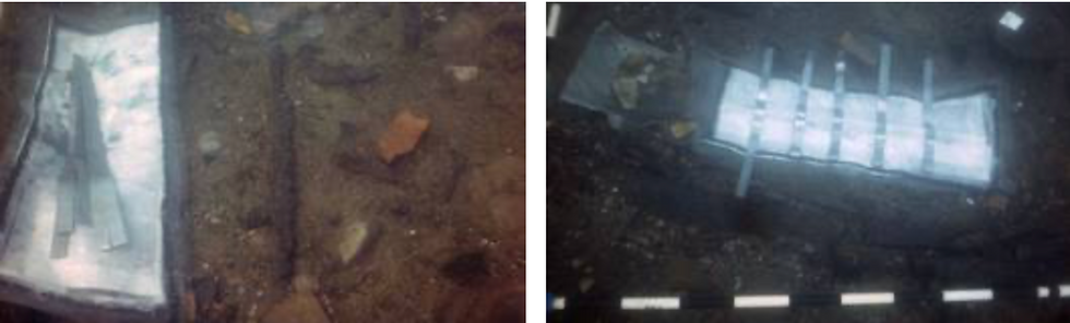
After waiting for the resin to harden (about 12 hours) the upper mat and the lower mat were placed with plastic clamps and brought to the surface (Figure 22c,d,e).

The carbon fibre fabric, impregnated with epoxy resin, is a real shell of protection that adheres to surfaces, protecting the artefact by rapid drying and preventing possible trauma due to the poor state of preservation of the material. Furthermore, the procedure and method may also act as an effective container for temporary storage of waterlogged organic objects.
Future work to be conducted at the ISCR laboratories include:
· testing organic and inorganic products for consolidating sediments.
· testing a system to “inject” polymers into sediment in situ
Laboratory work is currently ongoing to examine the use of polymers such as neutralised polyacrylic acid, Sodium polyacrylate and other Superabsorbent polymers (SAP) (also called slush powder). They are polysaccharides of high molecular weight (including Xanthan, Guar, Agar) and can absorb and retain extremely large amounts of liquid. The results of these tests will be presented in the future.
Effects of freezing sediments
To look at the effects of block lifting through freezing of sediment, an experiment was carried out at the laboratory of the School of Conservation in Copenhagen. The aim was firstly to see if fragile wooden artefacts would be damaged by the shock of freezing. Second, if there was no damage to freeze them in different sediment types (sand and gyttja) to see what effect this had on the process and if there were any significant weight changes.

Effects of Freezing
To assess the state of preservation of the wooden artefact before and after freezing, a small ca. 2000 year old, heavily degraded spear shaft (Figure 11) was cut into six pieces, where one was used to examine the density (81 kg/m3) of the wood and used as a control sample for scanning electron microscopy. The five other pieces were treated as shown in figure 13 and table 1.
After the pieces were weighed liquid nitrogen was poured over the five different setups (Figure 12). As soon as the “smoke” had cleared they were weighed again.

Table 1
Weight before (g) | Weight after (g) | |
Without water | 48,75 | 48,38 |
With water | 337,72 | 334,26 |
With gytje (3,5 x 7,5 cm) | 184,12 | 183,27 |
With sand (4 x 13,5 cm) | 414,31 | 412,61 |
With sand and water | 621,7 | 620,1 |
The pieces was treated in the five ways seen here and was weighed before and after liquid nitrogen was poured onto them.
As seen in table 1 only minor differences in weight were noticed from before and after the freezing treatment.
To evaluate the possible damaging effect from the freezing on the artefacts, SEM microscopy was carried out on the six pieces. No damage, collapse of cells, was seen after the freezing treatment (Figure 13). In figure 25d it is possible to see how a piece of waterlogged wood in this state of preservation looks in the SEM after uncontrolled drying.
These results show that the weight of the frozen sediment is almost the same as in an unfrozen condition and that the wooden artefacts are not notably damaged from the freezing. The future potential of this method will be evaluated when all methods within the Work Package are assessed.


Development of methods for block-lifting of fragile organic artefacts.
A system to block lift consolidated sediments containing organic artefacts will be developed.
Based upon previous experience from earlier attempts at raising complex and fragile organic artefacts (log boats, fish traps) a new type of lifting equipment will be developed which will consist of a complete unit which ensures that artefacts / sediment sections can be raised as a complete unit without having to be cut into smaller fragments. Furthermore it will be designed so that excavation can take place in a controlled manner and subsequently be completely secure during the raising, transport and following excavation in the laboratory. The equipment will be:
Modular so that it can be expanded / reduced to take account of different sized artefacts which can range from log boats (which can be 10 × 0.60 metres) to typical excavation sized areas (1.5 × 1.5 metres).
Barbara Davidde, Anne Marie Eriksen and Jørgen Dencker.
WP6
Status after the first year (WP6)
Burgzand Noord, The Netherlands
For years the Dutch Cultural Heritage Agency (RCE) has been working on the research and management of underwater cultural heritage. One of the focus areas of the RCE is the protection of archaeological sites for future generations. This principle is called in-situ preservation, and is also one the main points of the 2001 UNESCO Convention on the Protection of the Underwater Cultural Heritage.
For SASMAP, Work Package 6 partners joined to test the new in-situ preservation method, namely artificial seagrass, developed by SSCS. The RCE tested this method on the wrecksite BZN10, a 17th century shipwreck which sank on the Texel Roads, east of the island Texel (Figure 1).

Wrecksite Burgzand Noord (BZN)
On this location, threatened by natural erosion, ships anchored between 1500-1800 ready for transport of goods at the Amsterdam harbour. Despite the shelter the island provided from Northwest winds, hundreds of ships sank. One of these was the merchant ship BZN10, which carried Iberian jars, slate, barrels of grapes and anchovy, and several small objects. Although the wreck has been physically protected for over 10 years, additional methods may be necessary to preserve if for future generations.
Protective measures
The current protection comprises a cover with scaffolding mesh, which catches sand. From the annual (2001-2013) monitoring of Texel Roads using multibeam sonar to reveal erosion or sedimentation, it was clear that a scour gully was threatening the archaeological site. Therefore new measures were necessary, making this a good location to test the artificial seagrass in these highly dynamic circumstances (strong currents, lots of sediment in the sea).

After a few days of preparation, on June 12th, four 2.5 × 5 metre mats were deployed on the BZN10 wreck. Frond lengths of 62.5 cm and 125 cm were used in order to find the most effective protection. The mats were placed on the south east corner of the wreck site in the order of a short frond mat, then two long frond ones, and finally a short one. By using the deployment frame developed by SSCS, the mats were placed in less than two hours in rough conditions and poor visibility.

First results
Six days later a first monitoring was carried out, by diving the site again. This revealed that the fronds had already caught a lot of sand. The short fronds seemed to work better, as they remained longer upright thus catching sediment. The longer fronds had a tendency to quickly lie flat because of the strong current, thereby losing their sediment catching-effect.
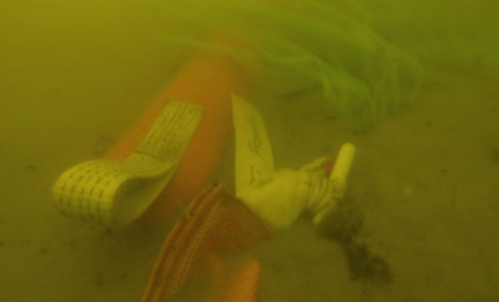
A second effect was that, because the fronds slow down the current, sediment had been caught up to two metres behind the mats. Because the layer of sediment caught by the fronds is dynamic (where sand is eroded, the fronds rise again, and start catching sediment), it could be a good method to protect the scaffolding mesh itself, which can easily be damaged. Monitoring over the next year will reveal if this effect persists.
First multibeam sonar results
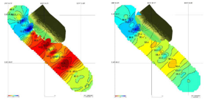
After a month the location was monitored again using multibeam sonar. This confirmed our first impressions that not only had the mats themselves trapped sediment, but behind the mats there was also sedimentation (Figure 5).

Tudse Hage, Denmark
Four frond mats were placed near the Danish site of Tudse Hage, a submerged Mesolithic site in approximately 2 metres of water, off the west coast of Sjaelland (Figure 6). The mats were not to be placed directly on the site, in order to be certain that the experiment did not negatively affect any archaeology in the area. Originally it was planned to use three standard mats with anchors for fixing and one edge weighted frond mat. All mats were green as opposed to the standard orange coloured. The mats were to be placed in four different areas. Just outside the area where archaeological remains are found (in ca. 2 metres water depth), to see if it could prevent and protect the areas closer to shore where cultural heritage was known to lie. As the standard frond size is 1.2 metres it was deemed that these may come too near to the water’s surface (the area is frequently visited by canoeists, fishermen etc.) and as with the Italian site green fronds of 0.8 metres were used. The three remaining mats were to be placed at 5, 7.5 and 10 metres water depth. The mats at 5 and 7.5 metres depths were standard mats with 8 anchors and 1.2 metre green fronds. The mat to be placed at 10metres was to be an edge weighted frond mat, again with 1.2 metre green fronds. Mats were generally oriented with the long edge (i.e 5 metres) in a north-easterly / south-westerly orientation in order to maximise the chance of catching sediment and dissipating currents running in from the Great Belt.

Initial trials were started in May 2013 (25 - 29th May) with the shallow water 2.5 metres mat. Normally, a hydraulic jackhammer is used to hammer the anchors into the seabed. Due to the requirements of large road compressors to do this, it was decided to trial the vibracoring system being developed in Work Package 3, together with a special spigot mounted to see if the anchors could be vibrated into the seabed – a synergy between the work packages which potentially may have made deployment of mats much easier.
The work was unfortunately hampered in the first instance by the initial placement of the mat in an area with a relatively thin layer of sediment overlying the compact clay rich natural subsurface. Because the anchors need to be 80 – 100 cm beneath the seabed in order to firmly anchor the mats, it was decided to move the mat. Furthermore the vibracorer, which has not been designed as a jack hammer, did not transfer enough energy to vibrate the large anchors into the seabed. It was therefore decided to move the mat to an area where the sediment overlying the natural substrate was ca 1 metre thick, yet still well away from the former coastline and outside the area of previous excavations. The original planned position was a clear area, but the only suitable location found was among scattered beds of natural seagrass, which had grown on the site in 2013. Finally an open area was located and a large 8 kg sledge hammer was used to hammer the anchors into the seabed – good experience had been gained with this method on the Haarbølle wreck. Because the Haarbølle wreck lies in a sandy seabed and the sediment of Tudse Hage is predominantly a thick organic gyttja, it took two divers, three hours to hammer the eight anchors into the seabed.

Based on this experience and the length of time taken on the most shallow site together with the number of diving cylinders required and with the risk of bad weather hampering the operation, it was decided to re-think deployment of the mats. After discussion with SSCS it was decided to use edge weighted anchor mats for the 5 and 7.5 metres areas – the original plan was to use such a mat on the 10 metres area.
The mats were rapidly prepared and shipped to the warehouse facilities of JD-Contractor A/S in Kalundborg, Denmark (http://www.jydskdyk.dk/) who had very kindly and generously offered to support the project with a jackup vessel, Marcos, that had a crane and crew helping deploy the Edge Weighted mats in the desired positions and was on its way from Nyborg to another job via Tudse Hage.

The logistics came together with the mats being loaded onto the ship and the frame being transported to Nyborg to meet it. On Sunday the 7th July, divers and a photographer from the Viking Ship Museum, along with Alan Hall from SSCS met in Skælskør harbour and sailed out to meet the Marcos. In the meantime the crew of Marcos had assembled the frame with the first mat ready for deployment and following instructions from Alan the mat was lowered into the water to a depth of 3.7 metres.

Divers from the Viking Ship museum followed and filmed the process under the water. The mat was moved into position by divers, positioned on the seabed and the safety net covering the plastic fronds released. The system, just as in The Netherlands, worked perfectly. Following this successful deployment Marcos moved to the next area (7.5 metres) and the process was repeated. On lowering this mat it was noticed that the webbing strops which the fronds are attached to were bowing. This was attributed to the edge weighted system not being fully taut. However, this was remedied by a diver stretching out the weighted bags at the edge of the mat – a relatively easy process for a single diver. Again the safety net and fronds were released without due concern. Marcos relocated again and the final mat was deployed in 10 metres of water – again with no problems.
The final mat took 6 minutes to deploy from leaving the surface to the fronds being released. The total time spent deploying the three mats was approximately 3.5 hours and the general feeling, certainly from those who had sledge hammered the anchors of the first mat into the seabed was that the new design of mats and method of deployment was a lot easier than the conventional anchoring system. Following deployment the mats were surveyed using single beam echo sounder (SBES) at a close line spacing as a way of monitoring any changes in the seabed topography and to see if there is any deposition of sediment on the mats and development of any scour pits around the mats.
Monitoring
Following the deployment of the mats and in connection with the work carried out in Work Package 3, the mats were re-visited in August (20-24th) and survey carried out using the SBES again. The mats were accessed by divers from the Viking Ship and National Museums with video and still images being taken. The post- processing of the SBES data is pending and the use of the method will be validated prior to the next phase of monitoring in the winter of 2013-2014. Although there was no sign of sediment accretion on any of the mats (there had not been any particularly heavy weather in the time since deployment) what was particularly interesting to note on all mats and particularly those at 10 and 7.5 metres, where there was no surrounding seagrass or vegetation in the area, was that they were a haven for various fish and fish fry and it certainly appeared that the mats were acting either as a nursery or an area of protection for these fish. Species of fish present were slightly different at the various depths and it is being considered whether more work should be done on classifying the types of fish present.

Further to the monitoring and in connection with WP3, the open water datalogger being developed was placed on the 5 metres mat (Figure 10). This was situated on the onshore and offshore sides of the long edge of the mat and logged for two days in each location. The logger records CTD data (conductivity, temperature and depth) and current strength and direction. In this way it was intended both to trial the logger but also gain information about the environment around the 5 metres mat.

Artificial Seagrass, Denmark
Baiae Deployment, Naples (Italy)
The artificial seagrass mats were placed in the Underwater Archaeological Park of Baiae, Naples from June 26th 2013 to July 6th 2013.
In order to install the artificial seagrass the Istituto Superiore per la Conservazione ed il Restauro (ISCR) Team (Dr Barbara Davidde director of the SASMAP’s ISCR activities, the architect Filomena Lucci and the scientific researcher Gabriele Gomez de Ayala) was joined by SASMAP partners Dr David Gregory from The National Museum of Denmark, Mr Jørgen Dencker from The Viking Ship Museum and Mr. Brian Smith and Mr Alan Hall from Seabed Scour Control Systems. Dr. Paolo Caputo, director of the MPA of Baiae (Soprintendenza speciale per i Beni Archeologici di Napoli e Pompei) and the underwater restorer Salvatore Carandente (SSBANP) also participated and we want to thank them for their cooperation.
The archaeological site of Baiae (Naples)
Baiae was a famous seaside town much prized in antiquity for its temperate climate, beautiful setting and the properties of its mineral waters that have been exploited since the second century B.C. It was the most popular resort among the Roman aristocracy and the Imperial family up until the end of the fourth century A.D., when a bradyseism i.e., gradual changes in level of the coast in relation to the sea level that have been positive and negative, caused the submersion of the city. Environmental problems in this area are related to a particular volcanic and deformational history. This coastal region has been characterised by periodic volcanic and hydrothermal activity and it has been subject to bradyseism. With the passing of millennia the original archaeological complex has been submerged and the archaeological remains are still underwater.
Today the remains of the luxurious maritime villas and imperial buildings, more modest houses, private thermae, tabernae, roads and warehouses and all the architectonic structures that characterise the cities of the Roman Age, lie underwater at a distance of up to 400 to 500 metres from the coast at a depth of 5-7 metres.
The interaction between natural processes and human activity has produced a marine environment characterised by a huge variety of natural habitats. For this reason in 2002 an Underwater Park, Marine Protected Area (MPA) was created covering around 176.6 hectares. The submerged area includes part of the territory of the ancient city of Baiae and Portus Iulius, comprising the Roman harbour and numerous constructions used as warehouses.
Today, visitors to Baiae MPA can choose between a number of guided tours including the Villa con ingresso a protiro, the Villa of Pisoni (with mosaics, thermae and mansory), the Ninpheum of Punta Epitaffio (including copies of statues of the imperial families), the Portus Iulius and of “Secca Fumosa” (a series of 12 massive pillars recently recognised as the remains of the Thermae built in the sea by Marcus Licinius Crassus Frugi mentioned by Pliny by Pausanias). These tours are open to the diving public and to non-diving visitors that can the visit on a boat fitted with a transparent keel.
Two thermal plants are also located in this area, together with the villa’s marine quarter – situated in the south of the courtyard – that included two landings with a quay, tanks to collect water and fishponds. The sea quarter was defended by twenty-five pilae inserted on the sea bottom.
The residential part of the villa has not been found yet. The architectural decorations still existing are made of marble, stuccos and polychromatic paintings.
The Villa con ingresso a protiro
The complex of the Villa con ingresso a protiro (Figure 12) is located at a depth of 5 metres. The villa underwent a second construction phase represented by the building of a wide apsidal room south of the hall. The room had two floor levels, built from large white marble sheets which were used as covers for the walls as well.
Deployment of the mats
Villa con ingresso a Protiro
In this location the effects of the artificial sea grass on the environment will be tested. The dimensions of the mat are 2.5 × 5 metres, with 1.25 metres long orange fronds. The location was monitored prior to the placement on 6th July 2013 and after the placement on 6th September 2013.

Artificial Seagrass, Italy
Initial results
As the mat is populated by different species of fish (Figure 13), it appears to be well integrated into the marine environment. ISCR biologist Sandra Ricci will continue the study on the biological colonisation of the fronds of these mats and of the others positioned in the Villa dei Pisoni.

Villa dei Pisoni
After long deliberation it was decided to change the planned position of the mats. The part of the wall of the viridarium of the Villa dei Pisoni originally chosen proved to be unsuitable, as a lot of archaeological structures collapsed near the wall, which could have a negative influence on the results.
Mats of dimensions 5 × 1 metre (1), 7 × 1 metre (1), 5 × 2.5 metres (1) and 5 × 2 metres (3) were installed (Figures 14A-F). All the six mats had short green fronds (0.625 metre). But as it was impossible in Baiae to use a large ship with crane, necessary to place the edge-weighted mats, a new method for anchoring the mats had to be found. SSCS developed a special skirt around the edges of the mat, on which sandbags could be placed to weigh them down. Although this system requires the filling of a lot of sand bags (in Baiae 150 bags filled with around 4500 kg’s of sand were used), it proved to be easy in use with smaller boats and kept the mats in place.

Monitoring
The following equipment is being used by Gabriele Gomez de Ayala, a ISCR collaborator, to monitor the site:
SSS Ecocos (high variable frequency side scan sonar)
HD Dynamic (dynamic positioning system)
SensCos (current direction and intensity, light and temperature sensors) (Figure 15-19)
Naumacos L3 3D scanlaser

As sedimentation of soft sand continues, the seabed becomes softer. Therefore seabed hardness is an indication of sedimentation. The lower the seabed hardness value, the softer the seabed. The research area was monitored before, and 2 months after the placement of the mats. As figure 18 shows, the seabed became softer, showing that sedimentation took place.


Assessing the durability of materials used in the in situ preservation of underwater archaeological sites.


Examination of Plastics
Background
Plastics such as sandbags, geotextiles and debris netting have often been used for mitigating the deterioration of underwater archaeological sites. The chemical types, manifestations of degradation and breakdown pathways in fresh and saltwater have not been established. Because it is important to understand how long plastic materials can protect underwater cultural sites and to ensure that degradation of these plastics will not have environmental consequences, samples of the materials after use have been collected from sites managed by SASMAP members and their properties are being investigated at the National Museum of Denmark. Data will be used to assess their suitability for use with cultural heritage and ultimately to develop guidelines for selecting materials for use by cultural heritage managers.
Collection and preparation of samples
Samples of plastics were removed from archaeological sites underwater up to one year before they were evaluated. In order to slow their deterioration after collection and to avoid contamination, they were stored below ambient temperature and without direct contact to other plastics. Researchers at San Diego University who collected samples of plastics from San Diego Bay developed a protocol for storing samples that was adapted for SASMAP and is summarised below (Rochman, C.M et al., Long-term field measurement of sorption of organic contaminants to five types of plastic pellets:implications for plastic marine debris, Environmental Science & Technology, 2013, 47, pp1646-1654):
dry removed plastics as much as possible with kitchen roll
wrap samples in aluminium foil or aluminium trays
enclose wrapped samples in resealable, polyethylene bags
place bags with clear labels in a domestic freezer at -20°C
24 hours before evaluation, allow samples to warm to ambient without removal from their polyethylene bags
Examination of samples, visible light and ultraviolet examination
In addition to examination in visible light, plastics are examined in ultraviolet (UV) light at wavelengths between 320 and 380 nm produced by a UVA-Spot 400/T supplied by Deffner and Johann. Many biological materials, especially active ones, fluoresce when exposed to ultraviolet light. They absorb ultraviolet light and re-emit it almost instantaneously. Because energy is lost during the absorption process, the emitted light has a longer wavelength than the incident which causes the material to glow or fluoresce. Plastics that have been moulded or cast contain UV absorbers from manufacture and therefore appear black in UV light.
Table 2: Results of visible and ultraviolet examination of SASMAP plastics
Findings from examination by ultraviolet radiation
Exposure to UV radiation was effective at distinguishing biological materials from their plastic substrates despite both being similar colours in some cases and the technique will, therefore, be applied to all plastics examined in SASMAP. Of the plastics examined, only RCE8, a blue, loose woven scaffolding net from south side BZN10 installed in 2001/2 and Greece 1, a hard white plate with numbering in marker pen and rust showed no evidence of active biological attack.


Examination by infrared spectroscopy
Polymer types in plastics and, where possible, any changes in chemical structure induced by being under water for at least 5 years were identified using non-destructive Attenuated Total Reflectance-Fourier Transform Infrared (ATR-FTIR) spectroscopy (Figure 28). ATR-FTIR is a standard technique to detect the loss or development of chemical groups present in polymers and additives in plastics eg plasticizers, anti-ageing additives. It can be used non-destructively. The technique is poorly sensitive to changes at the initiation of degradation but more sensitive to degradation at propagation stages (degradation in progress).
The surfaces of all samples were examined using a Pike MIRacle accessory fitted with a zinc selenide crystal in a Perkin Elmer Spectrum 100 spectrometer. Spectra were collected over 30 scans at a resolution of 4 cm-1 between 4000 and 600 cm-1. Spectra were compared with reference spectra run on the same instrument at the National Museum of Denmark.
Initial results
It is evident that the chemical composition of plastics cannot be determined from appearance alone. Scaffolding nets were made either of polyethylene, polypropylene or nylon despite appearing similar.
All plastics show signs of chemical changes after use under water with the exception of polymethyl methacrylate. This finding was interesting and unexpected because these plastic types have different degradation pathways and therefore would not all be expected to degrade under aquatic conditions. Polypropylene seemed more resistant to degradation than nylon 6.6 and polyethylene, which was physically degraded and readily stained with rust and biological materials. Polymethyl methacrylate was the most stable and polyethylene the least stable plastic for underwater use from this investigation.
It would be useful to know the oxygen content, temperatures and ultraviolet levels in the microclimates around the various plastics in order to further interpret the findings.
Preliminary conclusions
To test the artificial seagrass mats, three sites were selected in three different countries. Because of these different locations, the mats are tested in the most diverse circumstances. From the calm shallow waters of the bay of Naples, to the low current sea in Denmark and the rough Waddensea with its strong tidal movement, each of the sites has its own specifics. First of all the placement of the mats will be discussed. In both Denmark and The Netherlands the system of edge-weigthed mats was used. In both sites a big ship with heavy crane was used to place the mats. As it took only a couple of hours on each site to place all the mats, this can be regarded as a great success. Although there were some minor adjustments in The Netherlands (more suspension for the centre of the mat was needed), the weighted edges worked very well. Even in the rough tidal conditions the mats remained in their place.
In Baiae , Italy it proved to be impos-sible to use the big machinery to place the seagrass. The solution was to extend the edges on which sandbags were placed. Although filling and placing the sandbags took quite some time, it proved to be an adequate solution.
As expected, the strong tidal action and high sediment transport in the water caused the mats in The Netherlands to trap a lot of sediment. A surprising effect was that, because of the slowing of the current by the fronds, also 2 -3 metres on both sides of the mats sedimentation took place. After the first diving monitoring the shorter (0.625 metre) fronds appeared to work better, because the longer ones became trapped earlier under sand. In Denmark there was no visible sedimentation. Processing the data in the near future should reveal whether sedimentation has actually occured. Also comparing the data from the datalogger could be useful, as this will reveal the strength of the current and the amount of sediment suspended in the water.
Although there is very little current in the bay of Naples, some sedimen-tation did take place. Between mats 1 and 2 almost 50 cm of sediment was deposited. As expected the mats also caught soft sediment, as is visible in the cross section and hardness maps. It is expected that this sediment will cover the wooden structures.
Examining the plastic remains also revealed some interesting new information. After the initial investigations the plastic polymethyl methacrylate appears to have undergone no degradation, which would make it very suitable for protective materials. But as most of the research will take place in 2014, it is too early for definite conclusions.
Further research
In the next year monitoring of the mats will take place again using different methods: visual inspection, different sonar systems and 3D measuring systems. This monitoring should reveal what the mid-term effects of the artificial seagrass mats are. Is the sediment trapped on the mats themselves stable, or moving? And how does it effect the immediate surroundings?
Secondly the plastic-samples from the previous in-situ measurements will be further investigated by Yvonne Shashoua from the National Museum of Denmark. Hopefully this will reveal which materials are best to be used when trying to preserve an archaeological site in situ.
Finally the sites will be examined using the 3D-subbottom profiler being developed in WP2 in order to find out how the sediment is built up.
Thijs Coenen, Martijn Manders, Barbara Davidde, David Gregory, Yvonne Shashoua, Brian Smith and Jørgen Dencker
WP7
Status after the first year (WP7)
Dissemination is an integral part of the project, both in terms of publication of the achieved scientific results and promotion of the SMEs involved in the project. In the first year dissemination has focused on creating an awareness of the project primarily within the partner’s respective fields of academia and cultural heritage in general. To this end partners have presented overviews and specific elements of the project at numerous conferences many of which will be published in the relevant conference proceedings (*).
As has been noted previously the outcomes of the project will be published in two guidelines in 2015. A seminar / workshop is also planned for the final year of the project so interested parties can hear more about the results and see the tools developed within the project. The project home page, www.sasmap.eu is a key portal to the developments in the project and will be updated as significant results are achieved; photos, videos and other documentation from this year’s field work are currently being edited and will be uploaded onto the home page in the near future.
David Gregory
Confererences partners have presented at
Euromed 2012; International Conference on Cultural Heritage.Cyprus,
October 2012 (* published 2012)
Splashcos, EU COST action meeting: Offshore Industry and Archaeology: A Creative Relationship.Denmark, March 2013 (* in press)
European Science Foundation Workshop: Marine Woodborers: New Frontiers For European Waters.Italy, April 2013
International Council of Museums 12th Conference on Waterlogged Organic Archaeological Materials.Turkey, May 2013 (* in press)
5th Baltic Sea Region Cultural Heritage Forum: The changing coastal and maritime heritage.Estonia, September 2013 (* forthcoming)
Splashcos, EU COST action final conference: Under the sea: Archaeology and Palaeolandscapes.Poland, September 2013
Conference of the Australasian Institute for Maritime Archaeology: Towards Ratification, Australia’s Underwater Cultural Heritage.Australia, October 2013 (* forthcoming)
The Nordic Conference on Maritime Archaeology.Denmark, October 2013
EUPLOIA: Implementing Underwater Cultural Heritage ‘Best Practices’ in a Mediterranean Context.Italy, October 2013
Danish Research Agency Conference on Horizons 2020: Present day challenges future solutions.Denmark, October 2013
Consortium
The SASMAP Consortium
SASMAP brings together a consortium of 7 research institutions and 4 SMEs from 7 European countries. The partners comprise an interdisciplinary group of SMEs and institutional European partners with expertise in the development and production of state of the art marine geophysical instruments, equipment for measuring bio-geochemical parameters in the marine environment and hand held diving tools. The SMEs involved have very different commercial interests in the project and no conflicts regarding property rights are foreseen. Institutional partners encompass synergistic group researchers in marine archaeology and conservation, in situ preservation, wood degradation, marine geochemistry and marine geophysics working in museums, universities and governmental institutions with relevant know-how, facilities and resources to realise SASMAP.
Partner 1. NM - The National Museum of Denmark
The National Museum of Denmark (NM) is the largest and oldest museum in Denmark. From its foundation in 1807 the museum has carried out research into the excavation, collection, preservation and presentation of cultural heritage from Denmark and around the world spanning from prehistory to the present day. The Department of Conservation comprises around 60 conservators, craftsmen, scientific researchers and support staff who have expertise in conservation and restoration of archaeological, historical and modern materials.
Key Persons:
Dr David Gregory is a senior researcher at NM. He has researched the deterioration of archaeological materials and their in situ preservation in terrestrial and marine environments for twenty years obtaining his PhD in the deterioration of archaeological materials in marine environments in 1996. Originally trained as an analytical chemist he is a qualified commercial diver, archaeologist and maritime archaeologist but has worked predominantly with conservation science the past 15 years at NM. He has been partner in two EU projects and has coordinated several projects involving the successful completion of three PhD and two Masters Studies. He is author of more than 50 scientific publications.
Dr Henning Matthiesen is a senior researcher at NM investigating the in situ preservation of archaeological materials in wetlands and urban deposits. He has a BSc in Chemistry and Mathematics, MSc in Chemistry, and PhD in the biogeochemistry of marine sediments 1998. Prior to joining NM, he worked as an analytical chemist in industry. He is author of more than 50 scientific publications
Dr. Yvonne Shashoua is a senior researcher at NM investigating the degradation mechanisms and conservation techniques for synthetic materials. She took a first degree in industrial chemistry before working as an industrial polymer technologist for Berger Paints in England, UK. She joined the British Museum, London, UK, as a conservation scientist in 1988, specialising in the deterioration reactions and conservation of cellulose nitrate, cellulose acetate and rubber objects after 1993. In 2001 she successfully completed her PhD into the deterioration reactions associated with plasticised PVC. She has more than 70 scientific publications on conservation issues.
Partner 2. IMAR - INNOMAR Technologie GmbH
Founded in 1997 by a team of leading engineers, INNOMAR Technologie GmbH works in the field of development, production and application of efficient underwater acoustic systems, marine electronics and software. Today the main focus is on development and production of parametric sub-bottom profilers (SES-96 / SES-2000). This includes enhancements of existing products and adaption for new applications and markets as well as development of new products. Up to July 2011 more than 140 SES-96/SES-2000 parametric sub-bottom profilers have been commissioned by customers in more than 20 countries around the world. The product range also includes high-frequency sidescan sonars to complement the sub-bottom profilers as well as post-processing and visualization software.
Key Persons:
Dr Jens Wunderlich is R&D manager at INNOMAR. He received a master degree in Electrical Engineering and a PhD in Technical Acoustics from Rostock University. For more than 15 years his work and research activities have focused on underwater acoustics and digital signal processing.
Stefan Erdmann received a master degree in Electrical Engineering from Rostock University and has developed underwater acoustic equipment for more than 10 years. As senior engineer he mainly works on analogue and digital signal processing as well as software engineering.
Partner 3. UNI - Unisense A/S
Unisense is a world leading manufacturer of microsensors and instrumentation for microscale measurement. Unisense provide high performance microsensors and complete measuring systems for a full range of applications in environmental and medical research. We are dedicated to providing researchers worldwide with excellent support and complete solutions in the laboratory as well as in the field. Unisense was established in 1998 and is largely owned by scientists. Today Unisense is composed of a dedicated team of 18 employees of which 2/3rds hold a Ph.D mainly with microbiology and engineering.
Key Persons:
Dr. Mikkel Holmen Andersen is Chief Technology Officer at Unisense A/S and leads a team of 6 electronics and software engineers involved in designing and constructing high-end underwater datalogger and benthic measurement systems. He took a first degree in biotechnology and chemistry before successfully completing a PhD within the same field. Following a 2-year post doctoral position working with tumour vaccines in Paris, France, he joined a start-up biotech company, Borean Pharma, in Aarhus, Denmark working with several new technologies and leading these projects to proof-of-concept and eventually IPR sales. Thus, prior to joining Unisense he had been working for more than 10 years with innovation management. He is author of over 15 scientific publications and 6 patents and holds a MSc in chemistry, and PhD in protein chemistry.
Partner 4. AKUT
AKUT is a small enterprise that has provided technically unique solutions to a number of well-known Danish museums and private corporations since 1996. The main focus has been computer managed interactive intermediation using video, light, audio and physical models (e.g. seabed model) in various combinations. Usually AKUT is involved in the whole process from idea, through production and installation, to documentation and training of customers. The customers are primarily obtained through recommendations from existing customers. AKUT has a very broad network of large and smaller enterprises and has access to expertise in the areas of programming and development of electronic and mechanical components.
Key Persons:
Mr. Robert Pedersen has been working with intermediation through AV and IT for more than 30 years, starting in the sector for education, and for the past 15 years as the owner of AKUT. He is educated in the fields of teaching, electronics and computers. He is a qualified advanced diver.
Dr. Poul Jensen obtained an MSc in forestry from The Royal University of Agriculture of Denmark 1976 and a PhD in diffusion and sorption in waterlogged wood 1996. He worked with FAO, The Technological Institute of Denmark. Head of The Section for Conservation of Waterlogged Archaeological Materials at the National Museum of Denmark from 1989 to 2001 and was employed as senior scientist, responsible for the research activities of the section, until 2011 before joining Akut. Main areas of research have been: impregnation, sorption, freeze drying, mathematical modeling of conservation, deterioration processes and in situ preservation.
Partner 5. SSCS - Seabed Scour Control Systems
Seabed Scour Control Systems Limited (SSCS) was established in 1984 to provide Frond Scour Protection Systems and Services to the Offshore Subsea Oil and Gas Industry. Following an intensive period of product development and on site trials by SSCS and major Offshore Oil and Gas companies, the SSCS Frond Systems were first put to commercial use at new and existing oil and gas development sites in 1986. These first applications to protect pipelines in the southern sector of the UK North Sea evolved quickly both in terms of the number of pipelines protected, the number of sites at which the SSCS Frond Systems were installed worldwide and the range of applications to include the Protection of Jack-up Drill Rigs, Subsea Structures, Platforms, Umbilicals and Cables. SSCS also performs Site Scour Assessment Studies which can be for specific projects related to existing and planned installations, and can provide the basis for the development of maintenance programmes and procedures.
Key Persons:
Mr. Brian Smith: Managing Director
Mr Robert Rurgess: Business Development Director
Partner 6. GEUS - Geological Survey of Denmark And Greenland
The Geological Survey of Denmark and Greenland, GEUS, is a research and advisory institute primarily involved with geological mapping, data collection and storage, and dissemination of geo-scientific knowledge. GEUS provides state-of-the-art geo-scientific knowledge of international standard and co-operates with scientific institutions and other organisations around the world, such as Danish and Greenland research institutions and agencies i.e. EuroGeoSurveys (EGS), and the European Environmental Agency (EEA). The GIS-software at GEUS is Arc/Info and ArcView supplemented by MapInfo and specialised systems as Z-Map+.
Key Persons:
Dr. Zyad K Al-Hamdani is a senior researcher in GEUS. Worked with geophysical prospecting and data processing for 10 years. Worked as an assistant professor in the university for 7 years. Worked as a researcher in GEUS for 10 years. Responsible for seabed habitat mapping and processing. Contributed in different national, European and International projects. Major research projects: EU projects: BALANCE, 2005 – 2007, WreckProtect (Workpackage leader) 2009-2011, EUSeaMap, 2009-2011, BALTSEAPLAN, 2009-2010. Worked in the National projects (Denmark) for mapping archaeological sites in the Danish waters in Horns Rev Windmill project, in Rødsand windmill project, in Størstrommen cable line project and in Anholt wind mill project.
Dr Jørn Bo Jensen; senior researcher at GEUS. 25 years experience as a geologist, mainly on marine geological interpretation in Danish and International waters; High-resolution sequence stratigraphical interpretation of shallow seismic and coring data; Experienced in interpretation of Pleistocene stratigraphy in the Danish region; Detailed knowledge of Late Pleistocene and Holocene evolution in the Baltic region; Experienced in project management of large marine geological multidisciplinary studies; extensive expertise in shallow seismic and sonar investigation.
Dr Jørgen O. Leth M.Sc. (1987) and PhD in Marine geology (1998). 22 years experience as a marine geologist with focus on the Quaternary deposits and seabed sediments. Experience with sediment transport and sedimentary processes. Specific experience of exploration of marine aggregates and mapping of marine habitats. Project management of geological multi-disciplinary studies. Member of the Marine Expert Group of the EuroGeoSurveys.
Mr. Frants von Platten-Hallermund is a GIS-specialist at GEUS. He has worked with GIS systems for 20 years and has extensive experience in converting and combining data from different sources, raster calculations and analysis, establishing automated procedures for GIS data handling and analysis and publishing WEB based maps. Participated in the preparation of Danish Continental Shelf submissions, BALANCE and WreckProtect EU projects.
Dr Peter Rasmussen is a senior research palaeoecologist at GEUS. His primary research area is post-glacial terrestrial and aquatic vegetation history, particularly the ecology of anthropogenic disturbances and the biological effects of climate change using a series of sediment proxies. He has an extensive experience in lake and marine sedimentology, sediment sampling, pollen and macrofossil analysis, and sub-fossil wood identification.
Partner 7. VM - The Viking Ship Museum, Roskilde
The Viking Ship Museum in Roskilde was opened in 1969 and is the Danish museum for ships, seafaring and boatbuilding culture in ancient and medieval times. Besides exhibitions, a boatyard where visitors can watch shipwrights at work, an Activity Centre where the School Service is housed, a large sailing collection of traditional Nordic wooden boats, an Archaeological Workshop in which archaeological finds are documented using digital technology, a Maritime Archive on all Danish maritime archaeological finds, the Viking Ship Museum has a Maritime Archaeology unit carrying out marine archaeological investigations in connection to off shore construction work, rescue excavation and research excavations. The unit of Maritime Archaeology comprises both a staff of experienced marine archaeologists and craftsmen and is well equipped with boats, pumps and diving equipment for working underwater. The Viking Ship Museum has both experience and facilities in organizing and housing conferences, seminars and field schools and the vicinity at Roskilde Fjord makes it a perfect location for underwater field schools.
Key Persons:
Jørgen Dencker is curator, cand.phil and head of Maritime Archaeology at the Viking Ship Museum and one of the most experienced marine archaeologists in Denmark dealing with all aspects of maritime archaeology for more than 30 years: marine archaeological investigations in connection to a great number of construction developments at sea, rescue and research excavations of submerged landscapes and Stone Age settlements. He has also worked with: geophysical survey and interpretation of geophysical data, mapping drowned coastlines, prediction of location of submerged Stone Age settlements, excavation of well preserved submerged Stone Age settlements, development of methods and equipment for recovery of both small and larger fragile wooden artefacts and objects. Furthermore he has been involved in research on in situ preservation of both submerged Stone Age settlements and wrecks in cooperation with the National Museum of Denmark. He has been a partner in the EU project Wreck Protect and has been responsible for field schools, seminars and workshops on the survey and excavation of submerged Stone Age settlements in Denmark, Sweden, Faroe Islands and in methods on in situ preservation. He lectures on marine archaeology at a University level and is supervisor to a PhD student investigating submerged landscapes and Stone Age and has been a consultant in both Sweden and Norway in this matter.
Others. Besides Jørgen Dencker the Viking Ship Museum has a staff of fully qualified marine archaeologists who are commercial / scientific divers. These will be involved in the project in different work packages – primarily in connection with field work.
Partner 8. RCE - Cultural Heritage Agency
With the fusion of the ROB (Archaeology), the RdmZ (Built Heritage) and the ICN (Dutch owned art collection and research services), the Cultural Heritage Agency (RCE) of the Netherlands, is part of the ministry of Education, Culture and Science (OCW). It has expertise in the field of movable and immovable cultural heritage, all being combined in one institute, and also covers landscape research. The RCE employs approximately 300 people.
Key Persons:
Martijn Manders: Senior maritime archaeologist and head of the maritime programme at RCE. Martijn has been working in maritime archaeology since 1990. His specialisms are in situ preservation, monitoring and Underwater Cultural Heritage management. On these subjects he has published almost 100 articles and books.
Menne Kosian: Senior Researcher Spatial Analyses Landscapes. Menne is an expert in mapping the historical environment and publishes regularly on this theme including the submerged maritime landscape.
Bertil van Os: Senior Researcher degradation processes and maintaining preservation of the inorganic archaeological resource. Bertil has published numerous articles on in situ preservation of the archaeological remains and degradation processes. Bertil has a specific interest in the preservation capacities of remains in the marine sediments.
Partner 9. UGOT - The University of Gothenburg
The University of Gothenburg is one of the major universities in Europe, with about 37,000 full-time students and a staff of 5,300. Its eight faculties offer training in the Creative Arts, Social Sciences, Natural Sciences, Humanities, Education, Information Technology, Business, Economics and Law, and Health Sciences. The University’s unique breadth in teaching and research provides an interdisciplinary environment conducive to collaboration with private enterprise and public institutions. Undergraduate education and research work are intimately linked, and students at all levels have the opportunity to meet scholars of world renown. The quality of the University’s research is widely recognized and has been honoured with a Nobel Prize in Medicine in 2000. We play an active role in Sweden’s development towards environmental sustainability.
Key Persons:
Dr Charlotte Björdal; Conservator with PhD in wood science. Associate Professor and senior lecturer at the department of Conservation at the University of Gothenburg. Her background as object conservator of cultural heritage at the National heritage board in Sweden, led in year 2000 to her cross disciplinary doctoral thesis “Waterlogged archaeological wood; Biodegradation and its implications for conservation” at the Swedish University of Agricultural Sciences (SLU). From 2000 to 2005 she was researcher at the Department of Wood Science, SLU. Special expertise: wood conservation, wood degradation, wood protection, in situ preservation.
Partner 10. ISCR - Superior Institute for Conservation and Restoration
The Superior Institute for Conservation and Restoration (ISCR)(Istituto Superiore per la Conservazione e il Restauro), was founded in 1939 within the Italian Ministry of Cultural Heritage, to ensure that restoration activities would be carried out on a scientific basis and to unify the methods applied to works of art and archaeological finds. In 2007 the ICR became ISCR, the Superior Institutes for Conservation and Restoration and it is also the site of the Superior Training School for Restoration. Primary activities include carrying out research on the environmental, natural and accidental factors that deteriorate the underwater Heritage, and on the actions required to prevent and reduce the effects of such damage, and setting guidelines for conservation and restoration activities.
Key Persons:
Dr. Barbara Davidde Underwater archaeologist. Director of the Underwater Archaeology Operations Unit (ISCR). Adjunct professor of Underwater Archaeology – Rome 3 University- ISCR
Taken part in about 50 underwater surveys around the Italian coasts for identification of underwater archaeological sites and rescue of archaeological items. Project planner for projects involving both use of innovative techniques for the restoration of underwater archaeological structures, and Risk assessment and mapping of ancient remains. Member of the UNI NORMAL GL20 Wood Commission, Cultural Heritage Commission- Group Archaeological Wood
Dr. Sandra Ricci. Director of the Marine Biology Area in the Biology Laboratory of the ISCR. Member of the UNI Committee for the definition of methods and strategies about the study of the biological alterations of stone materials and for the control of the biodegradation.
Dr, Giulia Galotta graduated in Biology in 1992 and obtained a Ph.D in Wood Science at the University of Florence in 2000. Responsible for the “wood” section in the Laboratory of Biology at ISCR. Experience of identification of wood species and biological characterization of wood, both of archaeological and historical relevance. In particular, she has performed analyses for the evaluation of alteration in wood structure in order to recognise the various pattern of biodegradation. In addition, she conducts analysis for the physical characterization of waterlogged archaeological wood (measures of density, maximum moisture content, hygroscopic behaviour) for assessing the degree of wood alteration, in order to give suggestion for consolidation in the restoration procedure. Conducts research on the effectiveness of biocides for control of the heterotrophic microflora on wooden artefacts as well as to verify the susceptibility to biodeterioration of wood materials.
Partner 11. UPAT - Lab. Of Marine Geology and Physical Oceanography
The Laboratory of Marine Geology and Physical Oceanography (UPAT) was established in 1989 within the Geology Department of Patras University and is the largest teaching and research University centre in the field of Marine sciences, in Greece. The Laboratory conducts research projects in the area of marine geology, physical and environmental oceanography, coastal geomorphology and underwater archaeology. The personnel of the Laboratory include experienced academics and skilled scientific researchers in the fields of applied Marine sciences.
Key Persons:
Dr. Maria Geraga is a marine geologist with more than 18 years of experience in applied marine geology. She is a Lecturer of Archaeological Oceanography, in the Geology Dept. of the Univ. of Patras. Her research activities involve palaeoclimatology-palaeoceanography, marine archaeology and mapping of marine habitats pollution. She is/was researcher in national and EU research programmes (ASSEM, HYPOX). She has participated in marine geoarchaeological surveys in Alexandria of Egypt, in archaeological sites of Greece and in Cyprus. She has more than 18 articles in Int. Ref. Journals and more than 50 publications in Int. Conf. in the field of Marine Science.
Dr. George Papatheodorou is a marine geologist with more than 25 years of experience in applied oceanographic work. He is an Associate Professor in the Geology Dept. of the Univ. of Patras, with research interests in gas charged sediments, submarine gravitative mass movement processes, marine pollution and marine geoarchaeology. He was/is partner of many national projects and partner of EU research programmes (ASSEM, HYPOX) and joined marine geo-archaeological surveys in Alexandria of Egypt, in Cyprus and in Greece. He has more than 50 publications in Int. Refereed Journals and more than 100 publications in Int. Conferences.
Dr Kalliopi Baika is a archaeologist-diver, is curator in the Greek Ministry of Culture and Tourism and Visiting Lecturer of Maritime Archaeology in the University of the Peloponnese. She specializes in ancient harbours of the Mediterranean (PhD, University of Paris I, Panthéon-Sorbonne) and coastal archaeology. She has worked as a post-doc researcher in the Universities of London and Patras. She has directed several interdisciplinary underwater surveys in the Aegean (Sounio), trained under- and post-graduate students and participated in underwater excavations in the Mediterranean and has a large record of publications and international conferences.
Contact
Dr. David Gregory
National Museum of Denmark
Tel. + 45 33473522
Fax + 4533473327

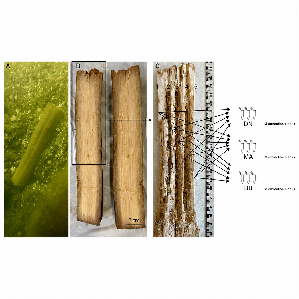

Comments